Friday, November 07, 2008

Kanchanaburi - The resilience of this little town amazes me.


Death, deplorable working conditions, war-stricken monuments are all part of a sad and dreadful history that allow for Kanchanaburi (a little known town) to go down in history books, to be included in the making of post world war II films, to lend to thriving tourism etc.

It is also a place where the story (of many years gone by) lies, as if cast in stone, with decaying mold all around it, in a dark, dingy misnomer of a museum called the Jeath Museum of War history.
Brace yourselves before you go here...even though, in appearance, it's a shack-like dilapidated structure, within its crumbling mud walls are plastered photographs and pictures that tell stories about the atrocities, violence and crimes committed by the Japanese forces against the POWs during the world war. It's gruesome, shocking and ghastly articles often times send chills down your bones. It is not something for the faint-hearted for on these decrepit newspapers and rundown picture frames, are displayed in-human acts of terror and treatment, of punishment and torture, or savagery and slaughter. The treatment of thousands of POWs and locals is beyond comprehension. So many lives lost for a bitter and indescribable cause.
Most deaths (more than 100,000) were caused during the construction and re-construction of the Death Railway (between Thailand and Burma), including the infamous Bridge over River Kwai. The one silver lining (of little consequence to those who lost their lives), is the beautiful and peacefully meandering River Kwai along the banks of which, the museum is reconstructed. As you step out from this surreal experience, you almost ironically need a breather from it all. The river flowing alongside offers a calm solitude and much needed respite from thinking about the horrors and degree of war crimes.
If you are anywhere close to the river, you cannot help notice, what could be the most visited section of the Death Railway, the large iron construction of the Bridge over River Kwai. The bridge was known simply as "Bridge 277," and while the Allied forces tried to destroy the bridge several times, it wasn't until mid-1945 that they finally managed to render the bridge over the River Kwai in-operable.
Popularized by a novel and later an Oscar-award winning film, the iron bridge you visit today is actually the second to span the river; the first was made of wood and lasted less than six months. Of course, it's partly because of this gruesome history that it's such an important World War II monument and such a popular tourist attraction.

While the Death Railway itself was only in operation in its more than 250-mile entirety for two years, today, a 47-mile stretch still sees regular train traffic and visitors can either traverse the famous bridge on foot or via a little tourist train which runs a 15-minute round-trip across the bridge and back.
The lives of thousands of war prisoners (mostly British, Dutch, Australian and American) who were victims of the Death Railway are laid to rest here. Maintained by the Commonwealth War Graves commission, the cemetery catalogs, via engravings on memorial plates, the deaths of young and brave soldiers forced into labor camps to work on the bridge and the railway line to Burma. The cemetery is very well maintained and tended to by local staff. Going through the rows of plaques, is a sober moment well deserving of our respect and recognition.

After all this history, death and gloom....one would imagine the town to be anything but alive and up-beat. Well, I was amazed at the resilience of its people. How quick they are to embrace the benefits of trade and tourism. There are those notorious floating raftels (raft hotels) with discos that play way into the early morning hours. If you love your sleep, make a note to not take up a room anywhere close!

Quaint little shops and stores offer all the good eats and buys. Tourists flock to them to buy souvenirs, T-shits, music CDs, you-name-it! The Thai people once again maintain a perfect balance between respect for their history and culture, and the prospect of the future which they look forward to with great anticipation and vigor. 

Thursday, November 06, 2008

Tiger Temple - Forest Monastery near Kanchanaburi


Okay, so at the very outset let me state that I was the skeptical one. My husband (once having seen the pictures, video and articles about this place) insisted that we go to the Tiger Temple and have it become the highlight of our trip to Thailand. Being that he was so gung-ho about it, we made sure to include it into our itinerary.
Wat Pa Luangta Bua Yannasampanno is quite a mouthful to say. Calling it Tiger Temple might be easier said than done.
My impression of a Tiger refuge and this place were world's apart.

Tiger temple is not the easiest to get to...not if you don't have your own means of transportation, or are traveling with a tour company that includes this as part of their tour. For people who prefer the bus or train, the options are limited. You can arrive by train or bus from Bangkok into the town of Kanchanaburi, and then take bus 8203 for Sai Yok and ask the driver to stop at the temple. The bus takes about 45 minutes to reach the temple and costs 25 Baht; this isn't the actual temple though. From the bus stop, follow the dirt road (1.5) km all the way to the front gate. The walk takes about 30-40 minutes. Factor in the heat and humidity...and you'll soon realize, this isn't the easiest..but it could be the most cost effective.

As I mentioned earlier, we hired a taxi for the entire day, so getting there was hassle free. Even otherwise, renting a taxi from the town of Kanchanaburi would cost about 200-250 Baht and take about 30 minutes or so. 
After paying 300 Baht per person as an entrance/donation fee, buying a T-shirt (another 300 Baht; see tip below) and signing waiver forms, I say to myself, this better be worth it...after all I am signing my life away here!!
The grounds look more like a reservation than a temple. We find a trail that leads us through rocky gravel and un-even ground to our first viewing of Tiger Cubs!! For someone who hasn't seen tigers live and in the flesh before, what differentiates a cub from its parent...hmmm...I wouldn't know. I was freaking out more because I had the thought ...could tigers (like dogs) sense my inner freaking out-self?? There was an Australian volunteer who re-assured me that they were babies, harmless, ultra cute, they love their bellies getting rubbed etc... all I saw were teeth and claws!! After my initial stomach churning moments, I summoned enough courage to step up and take a couple pictures with the 'babies' (yeah right, if you say so). The volunteered literally took my hand and ran it over their furry backs and bellies all the time assuring me, that this made them feel good....yeah but how did it make ME feel?? I sat gingerly next to the cubs leaning into (or out of) the picture frame to get it done! (Breathe)

Step 2 was the giant mommas....it was a short hike to the canyons where the tigers are brought out in the mid-afternoon. If I thought the cubs were big...these guys (or gals) were huge, enormous, and gorgeous - yes, but gigantic!!! I now understood what the volunteer meant when she called them babies earlier. Those were small compared to what lay in front of me. My goodness...how am I going to do this? I had already paid for my ticket...so there was no backing out. The waiver I signed said nothing about any cancellation fee…moreover I don't read Thai! So, it was settled...I was in...I was going to do it. I decided to stand in line along with 40 other visitors to get myself photographed with the big beauties.

Here is where my impressions changed, my skepticism (about this place) deepened, my fear replaced with sadness…after watching the sorry plight of these magnificent beasts. Tigers are supposed to be raw, feral, wild, impassioned creatures that tread the jungle, define territories, fend their young, hunt prey etc. That was not at all what I witnessed before me. Instead what I saw were stationary, utterly docile, passive, limp, flaccid mammals that never budged or moved an inch over the 2 hours that we stood in line. They never once purred or growled or yawned or made any sound or action. Wait…I probably saw one (of the 12 -13 tigers) flick a tail. That was about it. Why?

With so many tourists, visitors, children, volunteers…the place was buzzing with activity. Yes, agreed it was a hot summer afternoon, down in the canyons temperatures can soar even higher, the animals are nocturnal, yet, these beasts lay impervious to any sound, sight or smell…unyielding to any human activity around them. So many cameras flashing, people commenting, sometimes even laying on tiger bellies and yet, not one moved, not one awakened even momentarily, not even one opened an eyelid to scrutinize the surroundings. Why was it so strange? Were these mammals drugged, I had to ask myself. How else could their behavior be explained?
I didn’t know who to ask to get an answer. All I saw were numerous yellow shirted volunteers holding people’s hands, leading them to these animals, specifying where and how to sit to get photographed. It felt like a monotonous habitual routine for them - time tested and tedious. I did see one monk on the premises, keeping a watchful eye. He would intervene when any visitor paid a special (extra!!) price to have close-up pictures taken with the tigers head on their lap, or their head on the tiger’s belly etc.
After a point, I literally tuned out; the scare of facing a fierce wild beast exited my system. I felt pain for these animals and their exploitation through so called donations from the people. I didn’t notice any signs of malnutrition or abuse. Neither did I notice any signs of a sanctuary being built for which all donations were being raised. The animals did look healthy…just that, they were lifeless. I had decided then and there - the next time I see tigers it will be in the wild, in their natural habitat, and definitely from inside a covered safari vehicle.

Tip to foreign tourists - you must be dressed in knee length pants, skirts or shorts and must have sleeved shirts or t-shirts on. Sleeveless tops are prohibited inside the premises. My sleeveless top forced me to spend 300Baht on a Tiger Temple T-shirt available for purchase at the ticket office. I brought it back as a souvenir of the place.

Wednesday, November 05, 2008

Damnoen Saduak Floating Markets


The floating markets of Damnoen Saduak come highly recommended…the guide books rave about it, travel writers blog about it, TV documentaries rate it as a must see….so without question, we knew we were going there…if nothing else, to answer the question – “is this another tourist trap??”

Located about 100 kms from Bangkok (about 2 hours by road), this is a very doable day-trip. The highway system in Thailand is very impressive. If you can escape the rush hour traffic in and around Bangkok, the peripheral highways zip you to your destination quickly and smoothly. There are several transport options, buses, trains or taxi to get there. We needed the flexibility and had a lengthy itinerary planned for the day. It made sense for us to hire a taxi for about $80 which would take us to the floating markets and beyond. In addition to the Floating Market, this trip also covered:
Commerce on a canal….or another tourist trap?

Of-course other tour companies cover similar itineraries for much less, and if you are on a tight budget, then you should exercise that option. The cons however, are being bound to a fixed time table with a bunch of other tourists leaving little or no room for flexibility (or for your legs).
Damnoen Saduak floating market is truly one of its kinds. Even though, you might have framed a picture in your mind (after reading books, watching TV etc)…you still are overwhelmed by the intensity of it all. Is it the smell, the sounds, or is it the scene…is it the trade, the taste, or another trap…or is it the means of a living, a way of life, everyday commerce on a canal.

One trip to the market answers all of the questions above. What we discovered is that there really are two entrances to this fanciful bustling commercial market.
The Tourist entrance: This is the option that most tourists take. I would describe the experience here to be …well… touristy. Of-course you do get to experience the market in its entire splendor. Disarrayed paddle boats carrying everything from fruits, fresh produce to noodle & fried rice flood the scene that enfolds in front of you. Loaded onto these canoe-like small boats are cooking stoves, tender coconuts, spices and brimmed hats in all shapes imaginable. And oh by the way, they even transport tourists! It’s a mad cacophony of sound, sight, smell that overload your senses.

Encroaching the canal banks, and sprawled all over the jetty entrances, are teems of souvenir shops selling everything and anything; throngs of arriving pharangs (foreigners) might possibly be enticed to purchase. As shopkeepers hawk their wares, elderly ladies adorning bright wide brimmed straw hats, deftly maneuver the slim and impossibly tight waterways. They are always watchful for tourists who beckon them to buy their goods. Generally, their boats would carry fresh fruits … tender young coconut, or have the best noodles & curry freshly cooked boat-side and served!!

The market itself is vibrant, energetic and lively, in fact its so dynamic…you wouldn't’t want to blink your eyes at the risk of missing anything. What amused me was watching tour groups wearing like-colored hats to be easily identifiable and distinguished from other tour groups. All purple-rimmed hats…”follow me this way” and the green ones …” that-a-way”!!

The Not-so-touristy(?) entrance: If you took this route (for a few extra bath), you get to see and experience all of the above (there is no way, you want to skip that)…plus more! This is where you get a chance to move away from the hub of all commerce….to the wider, much quieter, sparsely populated back canals and waterways of Ratchaburi (the name of the town).

Here you get to witness first hand the lives of the common people, catch a glimpse of their traditional Thai teak homes built on stilts, spot the colorful yet intriguing spirit house located at the corner, outside their homes. As our boatman, steered us through this part of town, we saw a women with her young baby tied to her back in a sling, doing her dishes waist-deep in the canal; an older man, sunbathing, chatting up over a cup of tea; large earthen pots meant to store drinking water placed beneath their homes (the shade keeping the water cool).

The gentle bends of the khlongs (water canals) take you amidst rice paddies and fruit farms; we spotted Jackfruit, Mango and Lime trees. There were signs on the “right” to a snake farm/show. My relationship with reptiles is a nonexistent one; needless to say, we turned “left” on that bend! Just knowing there is such a farm in the nearby vicinity, gave me the creeps. You get the general idea don’t you?
En route this trip was a pit stop at a “Coconut sugar factory” as the boatman called it…what it was we learned later, was an expansive area showcasing artifacts made out of all parts of a coconut palm tree. There was also a fire pit demonstrating how palm sugar was extracted from the sap. The factory uses the old dead palm fronds and husks to fuel the fire to boil down the sap to a delicious sugar. It was quite amazing to watch how different parts of the coconut gave way to creative lamps, toys, wooden animals, wall hangings, chandeliers, you-name-it. If you can bypass the tourist gimmick and resist your own temptation to buy, this is a good break, to stretch those limbs, take a walk and admire the talent of the local craftsmen.

Few tourists visit this part of town, which is why when we passed by, a curious old grandma peered out of her rickety 2nd floor room window and shot our way the most adorable toothless grin, we ever received!!
We were asked to pose for a picture before getting into the long-tailed boat (for our tour), which seemed like a kind gesture at first…but beware, for within 2 hours, upon our return, there we were, all photo-shopped, pretty and dolled-up pasted onto a photo plate ready for sale - 150B only!! Also, there were a couple awkward moments - once or twice when our boatman stopped by specific souvenir stalls even though we weren’t interested to buy anything (it was his family-run store).

So what’s the final verdict? Touristy or not? I’d lean more heavily on the touristy part. Although I wouldn’t go so far as to classify it as a trap!! It helps to know before hand, what these trips are priced at, and bargaining here is acceptable, even encouraged by the shopkeepers. Keep in mind though that this is the livelihood of people who live, work and raise their families here. Taking the extended tour opens your eyes to the fact that for them, this is commerce on the canal. Your visit translates to their income. Saying ‘no’ with a big smile to large items, and price-tags that go with it is a simple way to relax and enjoy this exceptional sensory experience.


Tuesday, November 04, 2008

Jatujak (‘Chatuchak’) Weekend Market - Bangkok


Before visiting Thailand, I (or actually my better half) was forewarned about Bangkok being a shopper’s delight! Well….how misinformed I was!

The Jatujak (as pronounced in Thai) weekend market, transforms you into a shopaholic, eliciting the ‘shop-till-you-drop’ gene from your DNA, it manipulates you to showcase your bargaining skills…and leaves you desiring an extra pair of eyes that lend a 360 degree view of all its sounds, sights, smells and surroundings. This market was not just a shopper’s delight, it was the mother of all markets… It was the epitome of commerce, the ultimate personification of all things desirable, and the embodiment of the impulsive shopper in all of us!
A cornucopia of ‘you-name-it’ anything and everything under the sun!

Having said that, I hope I have prepared you to expect arrays of stalls, narrow by-lanes filled with artifacts, infinite maze of sois, one could so easily get lost amidst. In the midst of this complicated labyrinth, you will find continuous stalls selling clothing, shoes, art work, flowers – both fresh and artificial, fishes for your aquarium, fishes for the frying pan, cafes, restaurants, paintings, fabric to decorate, food to eat, souvenirs, trinkets, toys, Buddhas, jewelry, books, fake designer wear, not-so-fake-looking designer wear, watches in all sizes, colors and content, more Buddhas …the list goes on and on…all for the fraction of the price you would pay back home.

Hansel and Gretel couldn't find their way out of here even if they tried!!
How did we survive – you ask? We kinda stuck to the perimeter…and never ventured too much into the interior…there is a whole different world…that we didn’t even get to sniffing distance. Give yourselves plenty of time to cover this expansive market (think largest flea market, then multiply it times 100!!!)
Jatujak Market can be reached in a variety of ways, but arriving by Skytrain is by far the most convenient (except when its time to haul all those shopping baggies back, call for a taxi in those cases). Simply get off at the Mo Chit station, a terminus on the Sukhumvit line, and follow the crowd to the market. The Market is open every Saturday and Sunday from 9:00 AM to 6:00 PM. 
With more than 15,000 stalls situated on 35 acres of land and approximately 200,000 visitors a day, calling this market enormous is probably an understatement; it also makes it one of the biggest, most crowded outdoor markets in the world. So, if crowds, hot/humid weather, lots of walking are not your thing, then this isn’t for YOU. However, if you do decide to venture into this extraordinary market, dress appropriately (light clothing, good walking shoes) and keep the liquid intake going. There are delectable eats and refreshing drinks to be tried…the chilled lemon tea was excellent.
I guarantee you will not return from this place empty handed(no guarantees on an empty wallet though!!).
Happy bargaining!!

Monday, November 03, 2008

Foot Massage – the ultimate in Thai luxury!

After traveling three quarters of the world…across (who knows how many) time zones, changing 3 flights, spending way more time than we should have in and out of an airplane, cramped in the middle seat of a 3-seater economy coach class international flight, flanked by human beings who believe in the mantra – ‘sleeping (on such long flights) is the path to nirvana’…I could use a well deserved massage…ok….I was desperate for one!! I quickly learned that if massages are your fancy…then Thailand is your place! Funny, how some things are just meant to be.

(and then there is the part I absolutely do not remember)
The variety, range, options, style and price of Thai massages are as overwhelming as shopping for toothpaste in a large grocery store in the US (too many choices to select from). Thankfully, our gracious friends and host knew exactly the cure for my tired weary, circulation-deprived feet…and recommended a heavenly foot massage for 60 minutes!

Did I already mention, heavenly??? Wait till I describe it in detail...which by the way, I remember only the first 20 minutes off…after which I dozed off into la..la…land, into ethereal bliss..to a point of no-return. Here are excerpts from what I can remember… us being escorted to a sit-down half bath house, built out of teak and bamboo where we were waited upon (truly) by 2 masseurs who cleansed our feet …hand washed them with soothing warm water. It was a tickly sensation; we were then given house slippers to wear and lead to the massage room…where we discover to our delight these 180 degree comfy plush leather recliners.

The room itself is dimly lit…there is some lilting music one can barely hear, its soft and mellow. There also appears to be a feng shui water fountain in the background…I never did see it, but was aware of the sounds the subtle droplets of water made at a subconscious level. The ladies who settled us into our recliners, gently whispered amongst themselves as they occupied the foot stools opposite our feet to begin the massage. If ever there was a fleeting thought about getting a foot massage for 60 minutes (?)…it was quickly dismissed forever….and replaced by, when we could do this again!! The stillness of the room, soft murmurs of people’s breathe, and the adept experienced hands working on our tired feet quickly put me into a trance, took me away from the room and its surroundings, away from the present and into oblivion, after which point, there is complete and utter relaxation and nothing else.

        (and then there is the part I absolutely do not remember)

I awoke so well rested, as if I had slept for many hours…my feet felt alive and rejuvenated, my body recharged and revitalized and my spirit invigorated. I had never experienced something so wonderful and I am happy to be able to share with you – this quintessential Thai experience, a phenomenal foot massage! Never miss it…work it into your day, give up food (although Thai food is a tough call), if you have to…and make time for it. You…and I am sure your feet, will definitely remember it for a long time to come.

Sunday, November 02, 2008

Sukhumvit – the lifeline of Bangkok


If one were to look at the street map of central Bangkok, one would unmistakably recognize its most central arterial vessel – the Sukhumvit line. Intersecting the city with numerous ‘sois’ branching out into the inner suburbia of Thai neighborhoods, Sukhumvit is the place to experience a vibrant, bustling, cosmopolitan Bangkok.

From the 15th floor of a high rise apartment, the Sukhumvit neighborhood has a pulse and beat different from any other. Steel and concrete high-rises accentuate the skyline. They stand out in stark contrast to the many characteristically Thai architectural villas of a large opulent expatriate population that has called this neighborhood its home.
Sukhumvit – the lifeline of Bangkok, our base to explore Thailand from.

Crystal blue swimming pools (as seen from the balcony) give away the fanciful expat-lifestyle that beckons one to consider …hmmm…what would it cost to relocate?
Fast skytrains, taxis in fluorescent colors, multi-level glossy and extravagant shopping malls, restaurants, chic massage boutiques and plenty more, all make Sukhumvit very travel friendly, trendy, accessible and definitely livable.
We used this as our base to explore Thailand from. Not only is Sukhumvit central to Bangkok, Bangkok is central to Thailand, making this the perfect choice for us.

Some of the places that we traveled to within Thailand on this trip were: Bangkok, Ayuthaya (day trip from Bangkok); Kanchanaburi (day trip from Bangkok); Damon Saduak Floating Markets (day trip from Bangkok) and Krabi-Raileh (1.5 hours by flight to Southern Thailand).
Stay tuned to read more about all the above mentioned places.

Saturday, November 01, 2008

Where Orchids grow wild - THAILAND


How did we land on Thailand….well for one, it would be our debut travel venture into South East Asia. Secondly, it would give us the opportunity to meet friends from nearly 20 years gone by (enough reason to travel anywhere really), and thirdly, it was a break-journey option that we exercised on an extended vacation home.
After all was said and done, Thailand was one of the best decisions ever. We loved, treasured and cherished every moment of our stay and travel. We were awestruck, amazed, blown-away and drawn-to Thailand by its fascinating people, culture, tradition, beauty and grandeur. We were welcomed, nourished, entertained and enriched by everything in it.
What we took back with us permanently from this trip, though, was the abundant and radiant smile, the simple life and the peaceful nature of this nation’s people.

Thursday, July 03, 2008

Camping in the Rockies...for real this time!


Describing our weekend, all I needed to say to our friends was – “we went camping in the rocky mountains…” and there…just like that they had framed “the” picture in their minds, as if I special-ordered it for them!
Clear blue skies interspersed with powder-puff clouds, monolithic towering granite structures piercing through the painted canvas, evergreens and fields of Aspen lacing the slopes, lush green meadows and wild flowers lining the valleys in between highlighting the contrast in shapes, color and contours, fresh snowmelt laden waterfalls for a road-side diversion, and the mighty (and at times turbulent) Colorado river raging parallel alongside the road throughout. What more could one ask for…except for perhaps wildlife that is native to this wondrous land. Trust me, we saw plenty of those as well.
Setting up camp is a ritual I have now begun to really enjoy....tearing one down, is still something I am working on. 


If this isn’t the picture that you framed in your minds, then you are amongst those that really need to visit the place and see it to believe it for yourselves!There are numerous camping options that this scenic place offers…our friends and hosts chose Bogan Flats campground in Glenwood Springs, Colorado for our visit. Let me start by saying that the campsite locale was excellent. Although nearly 4 hours by road from Denver, there are detours plentiful to indulge in along the way. The campsite has the crystal river flanking it on one side, the mountains and gorgeous scenery on the other. Once you get used to the sound of gushing water, it almost lulls you to sleep. If I didn’t know better, I could have easily mistaken the sounds for the ocean waves…very peaceful and Zen. What you don’t get used to…is waking up to behold the stunning mountains and evergreen panorama that greets your morning. It is an imposing image that envelops you to make you one with nature.

Each campsite was spacious enough to accommodate 2-3 medium sized tents or a couple large sized tents…we were 6 of us in 3 medium sized tents as you see in the picture and were very comfortable with plenty of room to spare. In addition to that, there are trees, a picnic bench, fire ring with grill and space to park your vehicle. These campsites in addition to being spacious were quite private as well. With plenty of space and trees in between adjacent sites, you had your own little private world amongst the surrounding beauty.

Taking an early morning walk alongside the river revealed many campers and RVs parked in different sites with plenty of room for kids to have their play tent set up…adults to have their own tents and additional space for other “stuff”…I guess I have made my point, these sites were huge!

How you make the camping experience memorable is entirely up to you and your group. Ours will be a memorable trip mostly because of the great company and the choice of place. We grilled, made smores (the holy grail of camping outdoors), sat around the campfire and shared stories…and really took in all the place had to offer.
Setting up camp is a ritual I have now begun to really enjoy…tearing one down, is still something I am working on. This place tests you severely on the “tearing-down” part. Who would want to leave such a remote, wild and pristine place unless maybe a strong urge to shower!! Worry not mates, known for its Hot springs, Glenwood springs (the nearest town) has plenty of options to soak in commercial sulphur baths for some serious R & R. During peak season, these tend to get crowded. If you are adventurous enough, there are other options amidst rivers but you have to find just that right mix of hot ‘n cold to enjoy your dip.

TIP: Although Bogan Flats campground didn’t have shower facilities, it had the cleanest and most well maintained restrooms (vault kind) that we have come across. Hardly 5 miles shy of Bogan Flats, the Redstone Campground has showers and allows Bogan Flat permit-holders to share some of their facilities.


Wednesday, July 02, 2008

The First DETOUR - Mt. Evans


The first DETOUR…
Located about 3.5 hours from the city of Denver, it is not exactly close to the suburbs…however the drive comes packaged with a truly unique experience that blogs are written about! So, who’s complaining? Not me! Plus, there are several must-have detours and attractions along the way to keep your appetite for outdoors and nature going.
Mt. Evans Scenic Byway is also known as the Road-into-the-sky-drive.
One such detour was the Mt. Evans Scenic Byway also known as the Road-into-the-sky-drive. No points for guessing why it is called so. In just 28 miles, this beautifully paved byway climbs more than 7,000 feet to reach an altitude of 14,264 feet! The upper section of this road is the highest paved highway in North America.
Although, the vantage point from the seat of our car was very picturesque and comfortable, don’t be surprised to see avid cyclists, training uphill along the way to the summit. (Click on view more photos) With steep gradients amplified by the elevation, it calls for sheer endurance, determination and lung power.
Along the way, you pass through alpine lakes – Echo Lake and Summit Lake, several trail heads, trees and forested areas to finally reach elevations above the tree line. The Byway is dispersed with an amalgam of hardy mountain wildflowers, lichens and grasses where rock-jumping mountain goats and bighorn sheep can be spotted calmly grazing in the tundra. This along with the partial snow-capped mountains adds dramatic color and vibrancy to the viewing palette.
Closer to the summit you get to see the big picture—the entire Front Range and Continental Divide stretching out for miles in all directions. This highest of Rocky Mountain highs brings you to the rarefied world above timberline. We were told that it could be 90 degrees in Denver and 40 degrees at the top of Mount Evans...and it was!! Also, we are talking“Rockies” here….they are capable of creating their own weather systems…one moment clear and sunny, and next total clouds with white-out conditions and blowing snow!! Be prepared for sudden weather drifts. We were lucky to enjoy beautiful sunny, clear skies on our visit in July.
I overheard a fellow hiker mention that there are plenty of recreational activities to indulge in at Mt. Evans – Hiking the many trails, horseback riding, fishing in clear mountain lakes, camping, biking to name a few. Of-course the winter weather brings ski enthusiasts as well to this part of the Rockies.
Photographing the summit marker on top of Mt. Evans at 14258 feet adds proof to the pudding (or in my case to this blog). It’s definitely a memory you want to keep and relive for a long time to come.


TIP: Fall is a particularly delightful time of year to explore this area. However, due to the unpredictable weather conditions do call ahead for road closures and other park restrictions before heading out on a long drive. Located just off Highway I-70, in Idaho springs area, the article is aptly named a Detour for a reason. 

Tuesday, July 01, 2008

Camping in the Rockies


“Camping in the Rockies”….just the phrase has a ring to it…that perks your curiosity and paints a vivid picture in your mind about a far-away gorgeous place untouched by nature, pristine and wild in its beauty and utterly refreshing in its atmosphere.


Bogan Flats campgrounds in Carbondale, Colorado did live up to that utopian-like image and our weekend camping trip was enough reason for me wanting to go back again!

Friday, November 23, 2007

Hoodoos-Grottos-Narrows....don't worry, its all English!


So with horseshoe shaped amphitheaters that one can get lost within...to myriad colors and unique rock formations that demand your awe...from  breathtaking view points named aptly as Sunrise, Sunset and my very favorite - Inspiration Point...to elevations that span a range of 3000 feet... Bryce offers an unparalleled evocative landscape that stretches as far as the eye can see, and goes beyond your every single imagination. Taking all this beauty in...was the biggest challenge...alas we had just a pair of eyes to do it with!
 Now for some science and geology...to understand what those not-so-english-sounding words mean!!


A Hoodoo (interesting name isn't it?) is a tall skinny spire rising from the park basin, which is shaped by the constant erosion patterns of alternating hard and soft rock layers. The name given to the rock layer that forms hoodoos at Bryce Canyon is the Claron Formation.  Nowhere are hoodoos more predominant than in the northern section of Bryce Canyon National Park. A famous named Hoodoo at Bryce is the Thor's Hammer

Grottos are the result of erosion of softer pockets of the upper White Member of the Claron Formation. Excellent grotto formations can be seen all around from Bryce Point 

Walls or fins are narrow walls of rock, bound by joints or fractures on either side. As weathering and erosion open the cracks wider and wider they form narrows or slot canyons. A good example of this can be seen on the Navajo trail. 


Windows or arches are natural holes that form along cracks and weak spots in thin walls of rock called "fins." The distinction between the two is that bridges are carved by flowing water, whereas arches can be carved by everything else except flowing water. A great example of this is Natural Bridge


What can I write here that could come close to what I saw and experienced at this national park? What could I say, that could make you want to go there...and what could I give to go there again? One thing I could do, is to feel extremely fortunate that in my lifetime, I got to witness this pure magnificence.
Perhaps another time, a week here might be just what the doctor ordered...however, on this mini-grand circle trip, we spent 2 days at the park.

Our vocabulary saw a sharp rise during and after our visit to Bryce. Understanding how and why these interesting and unique shapes were carved out of rock and sandstone, millions of years ago...and knowing that the process continues as we speak...helped us really get personal with Bryce, its science and its characteristic geology.

TIP: There are excelled park ranger guided nature talks offered at the park. Check the visitor center for timings and to see if you can take advantage of these. You learn so much about what’s around you, and how it came to be!


Thursday, November 22, 2007

Bryce has many different 'POINTS' of view


THE DREAM....
It must have been twilight ...or sometime very early by my standards, I awoke to what felt like a very happening dream...the first thought that crossed my mind, an intensely strong pull to visit Inspiration point once more!
I sleep talked that night, and my words said - Inspiration..Inspiration point.
Was I crazy...was I dreaming....perhaps both and even more! My husband, as much perplexed as I, had this weird expression at 4:25am...he says "Darling...You were sleep talking..." WHAT??? I never sleep talk...so I was very curious and wanted to hear more. He went on to say "...you kept repeating the words, Inspiration Point, over and over again...!!"


WOW! The canyons had left such a profound impression on me...and of-course, I knew it was more than a dream, my conscience was speaking to me...and I knew exactly what I needed to do at 4:27am! We were going back inside the park, one more time, to experience the quiet solitude and transformational Inspiration Point! Its true, here at Bryce, you can feel yourself transform.
There are many many spots, sights, view points, vistas that delight every sense of your inner being here. We made sure to visit each one of them not only to experience the surprise that unfolded amongst its deepest layers, but also to claim our rights to our most favorite of them all. For me it was Inspiration point, for my husband, it was Bryce point (I liked that one too)..for my family it was sunset point (ok, I liked that one too)...see what I mean, there isn't one best of them all. All of them are too good to miss...so my advise to you, see them all! And if you think, you don't have time...waking up at 4:25am hopefully will give you inspiration!!


BRYCE POINT
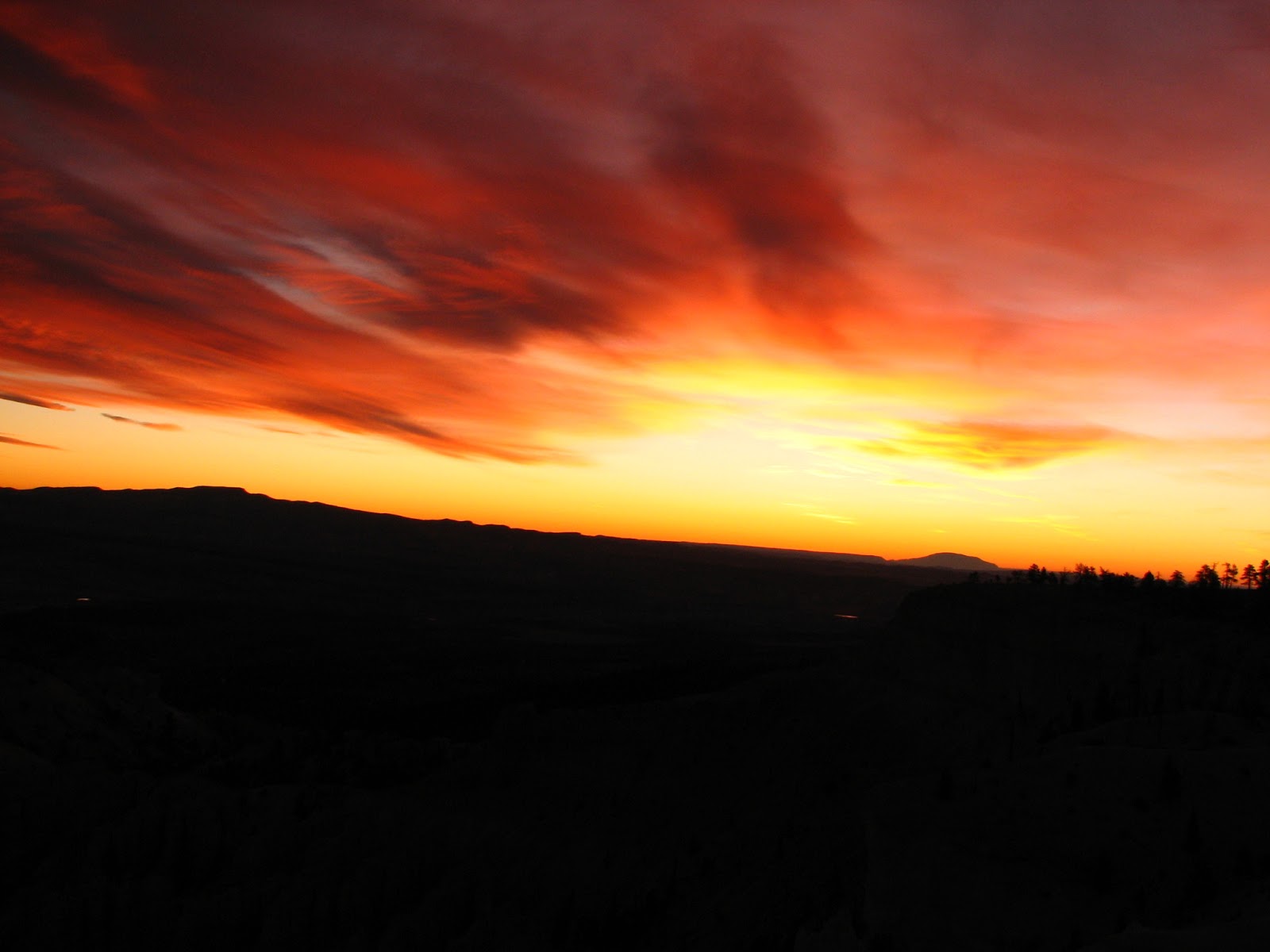
What a glorious full circle amphitheater view you get from here! The park ranger recommended this to be THE point to watch the sun break over the horizon in the morning...and we have to say, hands down, it was one of the most sensational sunrises we have ever witnessed. At 6:00am, with temperatures hovering around a bone-chilling 5 degrees farenheit, you might imagine, who would be that brave and bold to venture out in the cold?? Well...you already know the answer to that one, don't you? This is the land of sunrises and sunsets and being there to watch them is the most quintessential experience that you absolutely cannot miss. So bundle up, dress in layers, have a thermos of hot chocolate in hand...and cuddle up with your loved one, because this is one morning, you can never forget!


SUNRISE & SUNSET POINTS
Of-course, as the name suggests, these are great vantage points to watch the sun rise and fall into oblivion...but what makes them popular, is that they are centrally located, and easy to get to, especially when each passing minute can reveal a different dance of light and color on the maze of hoodoos and fins packed in tight formations, rising above from the park basin.

There are also some excellent trailheads that lead deep into the park's floor amidst walls, hoodoos and slot canyons. The Navajo trail is one that is a sure delight and moderate in its steepness. One of the classic and well recognized hoodoo formation called - Thor's Hammer is distinctly seen from here, and is very camera lens friendly.


INSPIRATION POINT
Hands down, this took my breath away. I could go back to Bryce, only for this over and again. The color here, geography, the stillness and spirit moved me in ways more than words can describe.The viewpoint at Inspiration Point consists of three levels that provide varied spectacular perspectives of the main amphitheater. Any time of day, especially break of dawn, casts a spell of fire and ice that cuts through the atmosphere to light up the expansive city below one layer by layer at a time. Like fire, the orange light quickly spreads driving shadows from all but the deepest recesses of the amphitheater. The limestone caps atop the hoodoos add to the vibrancy and delight, Inspiration point beholds. I do hope that everyone gets to experience this moment once in their lifetime.


TIP: The park encourages visitors to start their auto tour of Bryce Canyon National Park by driving directly to the very southern end first. Trust me, you will not be disappointed. From here at Rainbow Point the entirety of the park stretches out before you back to the north. By the way, Rainbow Point is also the highest point in the park. Dress warm! Some other noteworthy points along the way are: Yovimpa Point, Agua Canyon, Natural Bridge and Paria Point. Anyway you look at it, Bryce can have different points of view....but each view point is spectacular!

Wednesday, November 21, 2007

Feel yourself transform at BRYCE CANYON national park


After experiencing one of the oldest national parks (Zion Canyon), if you even momentarily think, you've seen them all...really, stop and think again. What lay ahead on our mini-grand circle road trip was nothing short of the most spectacular natural formations carved over centuries of time. At Bryce Canyon, you are most definitely transformed both in your thinking and in your being.
Even though, each park offers a completely different perspective, something about BRYCE touches you like none other...and you leave the park a changed person. Ok! I admit, I am a bit biased to this one...hey, all of us have the right to our favorites! And maybe if I told you that we have nearly 500 pictures just from this national park alone...does that seal the deal??
something about BRYCE touches you like none other...and you leave the park a changed person.

 From Zion Canyon National Park, the drive to Bryce is less than 2 hours by road...flanked on both sides by stunning visuals. Traversing east on Zion-Mt. Carmel highway and then North on US-89, you come upon Dixie National Forest and the Red Canyons...it is impossible to miss this glorious prelude to Bryce Canyon National Park. This would be the introductory teaser that would make you want to see more...and see all of the rest!


The advantage of an early head start, is being able to witness beautiful landscapes unfold in layers right before your eyes as the sun rises higher into the sky. One has to be there , to take it all in. We didn't stop on our way to Bryce although the offer was extremely tempting...however the photographs of this sensational morning, did do some justice to our driving on by.

Tuesday, November 20, 2007

Zion Canyon Scenic drive cuts through the heart of the park

One of the most scenic roads inside the park is the Zion Canyon scenic drive. Wonder why they named it that!! There are many view points and vistas located on and near this drive, which makes this a very comfortable drive/hike activity. After some much needed R & R, we decided to explore more of the park, and set out towards, what we believed to be the Court of the Patriarchs on the right of the road!


There we were mighty proud of ourselves, posing in front of, taking pictures from different angles, admiring the sheer size and beauty of these magnificent rock giants, watching several other cars and passers-by give us quizzical looks and drive/walk on by! Not bothered by the lack of appreciation from other visitors, we spent, what we thought was time enough to justify 20 landscape and panoramic photos...and decided to move onto our next scenic view point on this drive. After about 300 yards or so, the brown descriptive sign board ahead read - The court of the Patriarchs (ahead on your left) !!!!!! So....who doesn't make mistakes??? This one, we will always remember and laugh out loud about!
Switching the royal court of Patriarchs with the made-to-look-alike one!

The "real" court of the Patriarchs was impressive....and somehow we had developed more respect for it, through our earlier folly! We told ourselves, we had to make sure the earlier 20 photos were tagged differently, compared to the next set that we were photographing! These are 3 pyramid shaped peaks - Abraham on the left, Isaac in the middle and Jacob on the right. Hiking up for about half mile on the Sand Bench trail gives you better views of the Patriarchs.


Continuing further along - Angel's Landing was the next point of interest along the scenic drive. Considered to be one of the most strenuous of hikes in the entire park, it was surprisingly also noted to be one of the most popular! Its a half-day hike, with steep gradients, sheer drop-offs and narrow walkways. However, more than the able-bodied, its the bravery and courage that propels one to meet this vertical challenge.

We were short on time (not on enthusiasm though), and so decided to switch this hike...for a couple of more moderate and short ones. What was fascinating though, as we approached the Angel's Landing, was this play of light and shadow on the face of the mountain. It formed a classic shape of a mountain biker coming down the mountain. At first, it was just me who was able to read the contours of the shadow, later the others were able to see it as well...hopefully, you are able to catch the outline in the picture (seen here) as well.

The Grotto and the Lodge - are other points on the drive...the Grotto...being a wide open picnic area with plenty of benches, fire grills, water and rest rooms. If this would have been summer time, it would have been packed with families enjoying a summer barbecue. This time of year (November)...the area was covered with a blanket of fallen gold autumn leaves, that rustled with the wind, as you drove along. It was quiet but for the sounds of nature. Right next to it, is the Zion Canyon Lodge built in 1917. Zion National Park is considered to be the oldest and most visited National Park in Utah.

One of the most popular and moderate hikes within the park is the Weeping rock trail hike. It is only about half-mile in distance, and not very steep. A round-trip could take anywhere between 30-45 minutes. The Weeping rock is an alcove cut by water into the cliff and is famous for its trickling streams of water, and for its hanging gardens of ferns and mosses that decorate and transform this sandstone canyon into a green paradise.  Dozens of tiny cascades of water drizzle their way over the edge of the precipice, making their way down to the pools of water below. During warm weather, this phenomenon can be a very refreshing one.


The destination of the hike is the moss and fern-covered eave of an overhanging cliff. With the fern fresh green on one end of the palette and the vibrant red sandstone on the other, the visual panorama is a stunning array of contrasts. The hike itself, is short and easy, with views of the Great White throne and other parts of Zion canyon.
Towards the north end of the scenic drive, are the picturesque Temple of Sinawava rock formations. These are giant canyon forms towering to nearly 2000 ft into the sky. Other noted rock forms carry names such a Pulpit, and Altar...lending to its name.
 

This is also the birthplace of the Riverside walk. This is definitely one of the easiest hikes, since its mostly level-walking and runs parallel to the Virgin river. However, as you walk towards the narrow, you get a good sense of the steepness and the convergence of canyon walls all around you. This is definitely the older part of the park...if you are lucky you can get to watch park wildlife in these sections. At 2 miles, this easy hike takes about an hour on a leisurely stroll. Its definitely recommended.

TIP: Another moderate hike  - The Canyon overlook trail is located to the east of the Zion - Mt. Carmel tunnel. This 1.1 mile (approx 1 hour) hike is a fun one, leading to a charming alcove adorned with maidenhair fern. From here you get glorious views of the lower canyon and the switchbacks leading upto it. One your way out or in, its a great way to experience the magnitude and incredible beauty of this wonderful National Park.

Monday, November 19, 2007

Big and Tall - Zion National Park


Coming off of a high, after visiting coral pink sand dunes, the day had only just begun…it was still early…and Zion Canyon National Park beckoned as it was our next stop on our mini-grand-circle tour. A little over an hour’s drive (from Coral Pink Sand Dunes State park) located around the town of Springdale, is the majestic towering canyon formations that are a trademark signature of Zion.
The entire park spans a mammoth geographical area, which is why there are multiple entrances to it. The most common ones being on the Zion-Mount Carmel highway, coming from the east or the south.
...where the roads are washed and painted with sandstone dye.

No matter how you approach it, it’s the stretch of road that makes the drive unforgettable.
And let me begin describing the road…first. It was amazing to note, that the entire road was shaded red/brown in color! As if years of washed sand trickling down the canyons, permanently dyed the roads to give it that distinct hue. Hopefully the photograph did some justice…quite fascinating to drive on dyed roads! It was as if, a third dimension was added to the already multicolored visual palette.


Coming from the east, the Checkerboard Mesa is definitely not your ordinary gatekeeper to the park! These are gigantic hardened sand stone buttes criss-crossed with hard lines that give it its unique name. Standing in its endless shadow, while trying to capture its length and breadth in a camera lens, its unimaginable, how centuries of geological time creates monoliths of this magnitude. Its a very humbling experience.
Tunneling through...In addition to the above, another spectacular feature of the east entrance to the park, is a 1.1mile long tunnel built through the canyons! A special feature of the tunnel is its 6 large window openings offering unparalleled views of the canyons and the park's geology. Although you cannot stop anywhere inside the tunnel...the short yet memorable journey through it, gives you enough of a glimpse, to make you want to see more.

There is however, parking area just outside the tunnel and some good hiking trails to take advantage of as well. The road after the tunnel loops and turns with switchbacks maneuvering you deep into the canyon abyss. If just the entrance alone is this intriguing, imagine, what the rest of the park has to offer?
Crawford Arch - some things you never can forget. This historic arch formation on Bridge mountain was one of them. Just outside the park's information center is a spot, from where you are to 'spot' this natural arch formation.

Its not an easy one to locate...considering the size of the mountain facing you...however, my mom (being the geography teacher) was the quickest to find it (she obvioulsy knew what to look for)...and now we were all frantically spanning the mountain, trying to locate it! It might have seemed small amongst the large scale of geographic formations all around, but (look at the picture) man felt miniscule in comparison to the arch. How big and tall really are the canyons at Zion??
There was still so much to see and do, we decided we needed a quick rest break, after all the driving before taking on the rest of the park. For the night, we stayed at the comfortable Zion Park Inn conviniently located just a mile away from the park entrance.

TIP: The entire park is so beautiful...I couldn't give you any better tips, than to make it here. The drive alone is well worth it. If animals and wild life are your thing, consider stopping by an Elk farm just outside the park and feeding elk, llama, big horn sheep, yak and other native fauna with the stunning Zion mountains in the backdrop. Its an up-close and personal experience.