Friday, November 23, 2007

Hoodoos-Grottos-Narrows....don't worry, its all English!


So with horseshoe shaped amphitheaters that one can get lost within...to myriad colors and unique rock formations that demand your awe...from  breathtaking view points named aptly as Sunrise, Sunset and my very favorite - Inspiration Point...to elevations that span a range of 3000 feet... Bryce offers an unparalleled evocative landscape that stretches as far as the eye can see, and goes beyond your every single imagination. Taking all this beauty in...was the biggest challenge...alas we had just a pair of eyes to do it with!
 Now for some science and geology...to understand what those not-so-english-sounding words mean!!


Hoodoo (interesting name isn't it?) is a tall skinny spire rising from the park basin, which is shaped by the constant erosion patterns of alternating hard and soft rock layers. The name given to the rock layer that forms hoodoos at Bryce Canyon is the Claron Formation.  Nowhere are hoodoos more predominant than in the northern section of Bryce Canyon National Park. A famous named Hoodoo at Bryce is the Thor's Hammer

Grottos are the result of erosion of softer pockets of the upper White Member of the Claron Formation. Excellent grotto formations can be seen all around from Bryce Point 

Walls or fins are narrow walls of rock, bound by joints or fractures on either side. As weathering and erosion open the cracks wider and wider they form narrows or slot canyons. A good example of this can be seen on the Navajo trail. 


Windows or arches are natural holes that form along cracks and weak spots in thin walls of rock called "fins." The distinction between the two is that bridges are carved by flowing water, whereas arches can be carved by everything else except flowing water. A great example of this is Natural Bridge


What can I write here that could come close to what I saw and experienced at this national park? What could I say, that could make you want to go there...and what could I give to go there again? One thing I could do, is to feel extremely fortunate that in my lifetime, I got to witness this pure magnificence.
Perhaps another time, a week here might be just what the doctor ordered...however, on this mini-grand circle trip, we spent 2 days at the park.

Our vocabulary saw a sharp rise during and after our visit to Bryce. Understanding how and why these interesting and unique shapes were carved out of rock and sandstone, millions of years ago...and knowing that the process continues as we speak...helped us really get personal with Bryce, its science and its characteristic geology.

TIP: There are excelled park ranger guided nature talks offered at the park. Check the visitor center for timings and to see if you can take advantage of these. You learn so much about what’s around you, and how it came to be!


Thursday, November 22, 2007

Bryce has many different 'POINTS' of view


THE DREAM....
It must have been twilight ...or sometime very early by my standards, I awoke to what felt like a very happening dream...the first thought that crossed my mind, an intensely strong pull to visit Inspiration point once more!
I sleep talked that night, and my words said - Inspiration..Inspiration point.
Was I crazy...was I dreaming....perhaps both and even more! My husband, as much perplexed as I, had this weird expression at 4:25am...he says "Darling...You were sleep talking..." WHAT??? I never sleep talk...so I was very curious and wanted to hear more. He went on to say "...you kept repeating the words, Inspiration Point, over and over again...!!"


WOW! The canyons had left such a profound impression on me...and of-course, I knew it was more than a dream, my conscience was speaking to me...and I knew exactly what I needed to do at 4:27am! We were going back inside the park, one more time, to experience the quiet solitude and transformational Inspiration Point! Its true, here at Bryce, you can feel yourself transform.
There are many many spots, sights, view points, vistas that delight every sense of your inner being here. We made sure to visit each one of them not only to experience the surprise that unfolded amongst its deepest layers, but also to claim our rights to our most favorite of them all. For me it was Inspiration point, for my husband, it was Bryce point (I liked that one too)..for my family it was sunset point (ok, I liked that one too)...see what I mean, there isn't one best of them all. All of them are too good to miss...so my advise to you, see them all! And if you think, you don't have time...waking up at 4:25am hopefully will give you inspiration!!


BRYCE POINT
What a glorious full circle amphitheater view you get from here! The park ranger recommended this to be THE point to watch the sun break over the horizon in the morning...and we have to say, hands down, it was one of the most sensational sunrises we have ever witnessed. At 6:00am, with temperatures hovering around a bone-chilling 5 degrees farenheit, you might imagine, who would be that brave and bold to venture out in the cold?? Well...you already know the answer to that one, don't you? This is the land of sunrises and sunsets and being there to watch them is the most quintessential experience that you absolutely cannot miss. So bundle up, dress in layers, have a thermos of hot chocolate in hand...and cuddle up with your loved one, because this is one morning, you can never forget!


SUNRISE & SUNSET POINTS
Of-course, as the name suggests, these are great vantage points to watch the sun rise and fall into oblivion...but what makes them popular, is that they are centrally located, and easy to get to, especially when each passing minute can reveal a different dance of light and color on the maze of hoodoos and fins packed in tight formations, rising above from the park basin.

There are also some excellent trailheads that lead deep into the park's floor amidst walls, hoodoos and slot canyons. The Navajo trail is one that is a sure delight and moderate in its steepness. One of the classic and well recognized hoodoo formation called - Thor's Hammer is distinctly seen from here, and is very camera lens friendly.


INSPIRATION POINT
Hands down, this took my breath away. I could go back to Bryce, only for this over and again. The color here, geography, the stillness and spirit moved me in ways more than words can describe.The viewpoint at Inspiration Point consists of three levels that provide varied spectacular perspectives of the main amphitheater. Any time of day, especially break of dawn, casts a spell of fire and ice that cuts through the atmosphere to light up the expansive city below one layer by layer at a time. Like fire, the orange light quickly spreads driving shadows from all but the deepest recesses of the amphitheater. The limestone caps atop the hoodoos add to the vibrancy and delight, Inspiration point beholds. I do hope that everyone gets to experience this moment once in their lifetime.


TIP: The park encourages visitors to start their auto tour of Bryce Canyon National Park by driving directly to the very southern end first. Trust me, you will not be disappointed. From here at Rainbow Point the entirety of the park stretches out before you back to the north. By the way, Rainbow Point is also the highest point in the park. Dress warm! Some other noteworthy points along the way are: Yovimpa Point, Agua Canyon, Natural Bridge and Paria Point. Anyway you look at it, Bryce can have different points of view....but each view point is spectacular!

Wednesday, November 21, 2007

Feel yourself transform at BRYCE CANYON national park


After experiencing one of the oldest national parks (Zion Canyon), if you even momentarily think, you've seen them all...really, stop and think again. What lay ahead on our mini-grand circle road trip was nothing short of the most spectacular natural formations carved over centuries of time. At Bryce Canyon, you are most definitely transformed both in your thinking and in your being.
Even though, each park offers a completely different perspective, something about BRYCE touches you like none other...and you leave the park a changed person. Ok! I admit, I am a bit biased to this one...hey, all of us have the right to our favorites! And maybe if I told you that we have nearly 500 pictures just from this national park alone...does that seal the deal??
something about BRYCE touches you like none other...and you leave the park a changed person.

 From Zion Canyon National Park, the drive to Bryce is less than 2 hours by road...flanked on both sides by stunning visuals. Traversing east on Zion-Mt. Carmel highway and then North on US-89, you come upon Dixie National Forest and the Red Canyons...it is impossible to miss this glorious prelude to Bryce Canyon National Park. This would be the introductory teaser that would make you want to see more...and see all of the rest!


The advantage of an early head start, is being able to witness beautiful landscapes unfold in layers right before your eyes as the sun rises higher into the sky. One has to be there , to take it all in. We didn't stop on our way to Bryce although the offer was extremely tempting...however the photographs of this sensational morning, did do some justice to our driving on by.

Tuesday, November 20, 2007

Zion Canyon Scenic drive cuts through the heart of the park

One of the most scenic roads inside the park is the Zion Canyon scenic drive. Wonder why they named it that!! There are many view points and vistas located on and near this drive, which makes this a very comfortable drive/hike activity. After some much needed R & R, we decided to explore more of the park, and set out towards, what we believed to be the Court of the Patriarchs on the right of the road!


There we were mighty proud of ourselves, posing in front of, taking pictures from different angles, admiring the sheer size and beauty of these magnificent rock giants, watching several other cars and passers-by give us quizzical looks and drive/walk on by! Not bothered by the lack of appreciation from other visitors, we spent, what we thought was time enough to justify 20 landscape and panoramic photos...and decided to move onto our next scenic view point on this drive. After about 300 yards or so, the brown descriptive sign board ahead read - The court of the Patriarchs (ahead on your left) !!!!!! So....who doesn't make mistakes??? This one, we will always remember and laugh out loud about!
Switching the royal court of Patriarchs with the made-to-look-alike one!

The "real" court of the Patriarchs was impressive....and somehow we had developed more respect for it, through our earlier folly! We told ourselves, we had to make sure the earlier 20 photos were tagged differently, compared to the next set that we were photographing! These are 3 pyramid shaped peaks - Abraham on the left, Isaac in the middle and Jacob on the right. Hiking up for about half mile on the Sand Bench trail gives you better views of the Patriarchs.


Continuing further along - Angel's Landing was the next point of interest along the scenic drive. Considered to be one of the most strenuous of hikes in the entire park, it was surprisingly also noted to be one of the most popular! Its a half-day hike, with steep gradients, sheer drop-offs and narrow walkways. However, more than the able-bodied, its the bravery and courage that propels one to meet this vertical challenge.

We were short on time (not on enthusiasm though), and so decided to switch this hike...for a couple of more moderate and short ones. What was fascinating though, as we approached the Angel's Landing, was this play of light and shadow on the face of the mountain. It formed a classic shape of a mountain biker coming down the mountain. At first, it was just me who was able to read the contours of the shadow, later the others were able to see it as well...hopefully, you are able to catch the outline in the picture (seen here) as well.

The Grotto and the Lodge - are other points on the drive...the Grotto...being a wide open picnic area with plenty of benches, fire grills, water and rest rooms. If this would have been summer time, it would have been packed with families enjoying a summer barbecue. This time of year (November)...the area was covered with a blanket of fallen gold autumn leaves, that rustled with the wind, as you drove along. It was quiet but for the sounds of nature. Right next to it, is the Zion Canyon Lodge built in 1917. Zion National Park is considered to be the oldest and most visited National Park in Utah.

One of the most popular and moderate hikes within the park is the Weeping rock trail hike. It is only about half-mile in distance, and not very steep. A round-trip could take anywhere between 30-45 minutes. The Weeping rock is an alcove cut by water into the cliff and is famous for its trickling streams of water, and for its hanging gardens of ferns and mosses that decorate and transform this sandstone canyon into a green paradise.  Dozens of tiny cascades of water drizzle their way over the edge of the precipice, making their way down to the pools of water below. During warm weather, this phenomenon can be a very refreshing one.


The destination of the hike is the moss and fern-covered eave of an overhanging cliff. With the fern fresh green on one end of the palette and the vibrant red sandstone on the other, the visual panorama is a stunning array of contrasts. The hike itself, is short and easy, with views of the Great White throne and other parts of Zion canyon.
Towards the north end of the scenic drive, are the picturesque Temple of Sinawava rock formations. These are giant canyon forms towering to nearly 2000 ft into the sky. Other noted rock forms carry names such a Pulpit, and Altar...lending to its name.
 

This is also the birthplace of the Riverside walk. This is definitely one of the easiest hikes, since its mostly level-walking and runs parallel to the Virgin river. However, as you walk towards the narrow, you get a good sense of the steepness and the convergence of canyon walls all around you. This is definitely the older part of the park...if you are lucky you can get to watch park wildlife in these sections. At 2 miles, this easy hike takes about an hour on a leisurely stroll. Its definitely recommended.

TIP: Another moderate hike  - The Canyon overlook trail is located to the east of the Zion - Mt. Carmel tunnel. This 1.1 mile (approx 1 hour) hike is a fun one, leading to a charming alcove adorned with maidenhair fern. From here you get glorious views of the lower canyon and the switchbacks leading upto it. One your way out or in, its a great way to experience the magnitude and incredible beauty of this wonderful National Park.

Monday, November 19, 2007

Big and Tall - Zion National Park


Coming off of a high, after visiting coral pink sand dunes, the day had only just begun…it was still early…and Zion Canyon National Park beckoned as it was our next stop on our mini-grand-circle tour. A little over an hour’s drive (from Coral Pink Sand Dunes State park) located around the town of Springdale, is the majestic towering canyon formations that are a trademark signature of Zion.
The entire park spans a mammoth geographical area, which is why there are multiple entrances to it. The most common ones being on the Zion-Mount Carmel highway, coming from the east or the south.
...where the roads are washed and painted with sandstone dye.

No matter how you approach it, it’s the stretch of road that makes the drive unforgettable.
And let me begin describing the road…first. It was amazing to note, that the entire road was shaded red/brown in color! As if years of washed sand trickling down the canyons, permanently dyed the roads to give it that distinct hue. Hopefully the photograph did some justice…quite fascinating to drive on dyed roads! It was as if, a third dimension was added to the already multicolored visual palette.


Coming from the east, the Checkerboard Mesa is definitely not your ordinary gatekeeper to the park! These are gigantic hardened sand stone buttes criss-crossed with hard lines that give it its unique name. Standing in its endless shadow, while trying to capture its length and breadth in a camera lens, its unimaginable, how centuries of geological time creates monoliths of this magnitude. Its a very humbling experience.
Tunneling through...In addition to the above, another spectacular feature of the east entrance to the park, is a 1.1mile long tunnel built through the canyons! A special feature of the tunnel is its 6 large window openings offering unparalleled views of the canyons and the park's geology. Although you cannot stop anywhere inside the tunnel...the short yet memorable journey through it, gives you enough of a glimpse, to make you want to see more.

There is however, parking area just outside the tunnel and some good hiking trails to take advantage of as well. The road after the tunnel loops and turns with switchbacks maneuvering you deep into the canyon abyss. If just the entrance alone is this intriguing, imagine, what the rest of the park has to offer?
Crawford Arch - some things you never can forget. This historic arch formation on Bridge mountain was one of them. Just outside the park's information center is a spot, from where you are to 'spot' this natural arch formation.

Its not an easy one to locate...considering the size of the mountain facing you...however, my mom (being the geography teacher) was the quickest to find it (she obvioulsy knew what to look for)...and now we were all frantically spanning the mountain, trying to locate it! It might have seemed small amongst the large scale of geographic formations all around, but (look at the picture) man felt miniscule in comparison to the arch. How big and tall really are the canyons at Zion??
There was still so much to see and do, we decided we needed a quick rest break, after all the driving before taking on the rest of the park. For the night, we stayed at the comfortable Zion Park Inn conviniently located just a mile away from the park entrance.

TIP: The entire park is so beautiful...I couldn't give you any better tips, than to make it here. The drive alone is well worth it. If animals and wild life are your thing, consider stopping by an Elk farm just outside the park and feeding elk, llama, big horn sheep, yak and other native fauna with the stunning Zion mountains in the backdrop. Its an up-close and personal experience.

Sunday, November 18, 2007

Pink is my pick for the day...Coral Pink to be precise!


At day break, as we left the town of Page, we found ourselves once again crossing state lines, this time from Arizona into Utah (no time zone change here). As we watched the early morning light wash the dark sky, all we could reminisce about was, what an experience the day before had been. Truly, Antelope Canyon was a visual treat.
On day 3 we were headed west on Highway 89 towards the city of Kanab, UT marveling the expansive Grand Staircase Escalante National Monument that stretched out to our north and northeast. Even though the grand circle is mostly made up of National Parks and monuments, if you’ve read the previous entry, you now know that this trip had to be more than that. Having reaped an enormous reward for going off the beaten path and enjoying places unparalleled, we couldn't pass up on an equally interesting prospect.
Coral Pink Sand Dune's rippling rust-colored arcs beg to be explored by one and all.

Another such uniquely rewarding and very refreshing detour happened to be Coral Pink Sand Dunes State park in Utah! (Day use $5, Camping $15) Just the name was enough to steer our car 12 miles off highway 89 past the city of Kanab. Our curiosity levels at an all-time high, we had this intuitive feeling of knowing we had made the right decision. Located a little over 2 hours by road from the town of Page, at first glimpse, the park appeared to be nothing extraordinary. It was the elevation of the plain that obstructed our view from what lay behind, above, over and under.

And then, probably a couple hundred yards shy of the entrance to the park, as we came on top of a small ridge, we saw it!!! It is hard to describe the exhilaration that flushed my insides – what a sight it was to behold! In the midst of gigantic rock, concrete and towering canyon walls, amidst layers of hardened lava, defying the science that contoured most of the surrounding geography, was a landscape astonishingly the opposite. It was one that was gentle not rough, smooth not jagged, wavy not straight and one that was soft not hard. And above all it was bathed in a soft Coral Pink glow!

The science or mystery behind these photogenic formations is very fascinating. Years of weathering and erosion of the surrounding Navajo Sandstone, deposited sediments carried over by winds to shape and form these dune hills more than ten thousand years ago. Now, that explains the light pink color. Situated at 6,000 feet, these 2,000 acres of park dunes are the result of winds funneling through a constricting notch between the Moquith and Moccasin mountains (south of the park). This increase in wind velocity, also known as the"Venturi effect", reaches the open valley, where it looses its speed, and deposits sand in this spacious reservoir.


Reading the excellent interpretive bulletin boards in the park, brought back memories from my high school geography class! It also was a sharp reminder of how little information we retain after school!!! But for now, I'll just pretend my mom didn't hear me say that (she was my geography teacher for 4 years)!! After reading more about it, we were able to recognize different formations such as barchans, parabolas, and a star dune (caused by winds coming from several directions) spread out right in front of us.


A thrilling way to enjoy the wide sweeping expanse of the park and hundreds of miles of quality trails is atop an OHV - Off-highway Vehicle, ATV - All terrain Vehicle, dirt bikes or Dune Buggies. Unfortunately, there isn't an option to rent these for day use....but if you own one, then this is paradise central for you! However, for all you 2-legged adventurists....don't be disheartened...for a little enthusiasm goes a long way if you are game for it! The best time for hiking is early morning, when its cooler, and when the angles of light produce shadows and colors that justify why the park was named so. Keep in mind though that sinking your feet into the extra fine soft sand can be tiring for an extended period of time. None-the-less...only a half mile into the park and atop the ridge of the barchan crest, all tiredness is forgotten only to be replaced by the timelessness of this spectacle. The sand dunes brings out the child in you, as you find yourself digging in more than just your toes into the coolness of its soft silt. With a spectacular horizon ahead of you, and being the only major dune-field in the entire Colorado plateau...Coral Pink Sand Dune's rippling rust-colored arcs beg to be explored by one and all. It is truly a well deserved off-the-beaten-path serene experience, not to be missed.

Interesting Facts: In Kane County's movie-making days a Hollywood production company thought Coral Pink Sand Dunes State Park resembled Egypt, and it was selected as location for filming "The Greatest Story Ever Told". All film extras were locals, with the only imported actors being camels! Many other old movies were filmed at the Coral Pink Sand Dunes including: "Arabian Nights" in 1942, "Ali Baba and the Forty Thieves" in 1944, "Timbuktu" in 1959, "MacKenna's Gold" in 1969 and "One Little Indian" in 1973.  In 1978 the series "Greatest Heros of the Bible" was also filmed at the Coral Pink Sand Dunes.

TIP: Best times for hiking are early morning. This way you avoid the noise of the ATVs...and have the place untouched and all to yourself. Also keep in mind that this is desert country. Take all the precautions as you would traversing any other similar landscape. Avoid the harsh mid-day sun...since shaded rest areas are hard to come by. Wear light clothing, and take plenty of water if you are venturing out on a lengthy hike. Definitely take your camera along.

Saturday, November 17, 2007

the village..the sun..and the sky


the village

Yes, they call it the Grand Canyon village ...although considering the size and expanse of the canyon, calling this place a "village" might seem ironical...but it does have a very characteristic charm complete with cozy lodging, comfort food and homely entertainment. There are plenty of options for all ages to explore the village....you could spend a week...and still not have seen it all. To add to its uniqueness, the village also offers seasonal plays at the amphitheater, nature programs, beautiful wildlife and panoramic vistas all around.

they shimmer like molten gold as if tens of thousands of mirrors lined its crest...

Most people visiting the south rim stay in and around the village and experience Grand Canyon one way...nothing wrong with that...although they never would realize that they just missed out on a whole other experience only a few miles away!
The East Rim drive towards Desert View is spectacular not only in what it visually offers to its patrons, it is very rewarding spiritually as well. Only 26 miles from the village, while getting here, you quickly learn (as we did), this place is all about unbelievable sunrises and sunsets...and everything in between. The possibility of capturing this timeless beauty with our eyes in person, was enough motivation to not have to wait for our alarm to jump start our morning. We were up early before the crack of dawn and ready to take in one of the most breathtaking sights on our journey.

the sun

This gentle winding road that skirts the rim of the east canyon, offers multiple wayside pull outs as well as marked view points, each offering an extremely rewarding panoramic view. Some that deserve special mention are Grandview, Lipan and Desert View. But what you receive in terms of visual delight far supersedes any stretch of imagination. It is recommended that in order to truly appreciate the beauty of sunrise over the canyon, you must get to your"spot" well ahead of the actual posted sunrise time (the visitor center clearly chalks out sunrise and sunset times for each day). 


With little to no light the gigantic canyon pit forms a faintly visible outline but what dramatically accentuates this sight are bands of early morning mist rolling in and encompassing the upper layers of stone and rock forming a silvery lining to the dark abyss beneath it . They seem suspended in mid air creating just a pale hue to reveal what lays underneath, above and all around it. As these giant rock structures tower through this cotton like haze, their tops are the first to catch the early morning rays of the sun. Far off in the distance, they shimmer and shine like molten gold as if tens of thousands of mirrors lined its crest. Intensifying in color, brilliance with each passing second the sun beams cut through bands of mist to wake the canyon to another  unimaginable and life changing morning.

and the sky

And after that mindblowing experience, we headed further east towards Desert View close to the east entrance to the park, and the highest point on the South Rim of the Grand Canyon. Originally set up as a trading post, at this scenic spot stands a 70 foot tall stone and concrete Desert Watchtower that not only photographs beautifully, it also provides sweeping views of the distant painted desert to the east, the stunning stretch of the meandering Colorado river down below and out in the distance 3000 ft high Vermillion cliffs bordering Utah.

The entrance to the watchtower is shaped like a Navajo hogan complete with a traditional log ceiling. It houses a fascinating gift shop with stairs leading upto the tower's four levels. The large circular walls as you ascend the tower form an expansive canvas depicting art work and painting about gods, wedding and other traditional Hopi petroglyphs. Black mirrored "Reflectoscopes" set out on the terrace of the tower, present a very unique perspective to see the canyon from, they seem to intensify the colors by eliminating the haze from the picture. Finally, on the fourth level, you can gaze out windows from the highest viewpoint on the South Rim—7,522 feet.

TIP: For security reasons, gas stations are not permitting within the Canyon. Your best bets to fuel up are either outside the park on the south entrance, or at Desert view just past the east entrance. There is also a small snack bar and grocery store at Desert View to gather up some munchies for the road.

Friday, November 16, 2007

Galloping herds of Antelopes...give it its fabled name - Antelope Canyon


Continuing east on Hwy 64 and then north on US 89, little did we think, that our next destination would leave such a lasting impression on us, for a lesser known quaint town of Page in Arizona became the most talked about highlight of our entire journey.
About two and half hours by road from the east rim of Grand Canyon, the trip to Page, AZ was a visual delight throughout. Running almost parallel to the road, the soaring vermillion cliffs kept us company and offered constantly changing kaleidoscopic views from all angles of the car windows.
In its core (quite literally), the town of Page, holds dear its most sacred secret.

After grabbing a quick bite at the heart of town (which offers all fast food options), we were ready to embark onto possibly one of the most adventurous parts of our trip. Looks can be deceiving and I urge you not even for a moment to suspect this to be a laid back town with not much to see or do...it is quite the contrary ...as you will realize once you read further.
Antelope Canyon is a one-of-its-kind natural formations of otherwise popularly known Slot Canyons. What lends to its unique character is the fact that these canyons are formed by the carving/erosion of soft Navajo sandstone by the sheer forces of nature (rain water and wind). But what you are least prepared for, is the off-the-beaten-path approach and the unbelievable spectacle that awaits you!

Since the canyon is situated within the Navajo Tribal Park, it can be accessed only via guided tour led by tribal leaders. Depending on the nature and duration of the tour, it is priced anywhere between $30 - $50 per person. Totally worth every penny. Trust me! Just the drive upto the slot canyons feels like a safari...complete with its own 4WD ride over desert like sand, actually dried up river beds as we understood them to be later. The song that was perpetually running through my head was La Bionda's Sandstorm..."dust in my eyes...in my ears..." because it was so true... excitement built up even as fine grains of sand lined the inside of our mouths!


An inconspicuous exterior looked no different from a crack in the wall albeit a large opening. It was after stepping into the dark chamber, when our guide raised her torch to reveal formations never ever seen or heard of before. Could such a place truly exist? Isothermal patterns left fossilized impressions on the soft sandstone that framed the crevices and steep canyon walls around us. The insides had been smoothened down from years of erosive water action. It was only later our guide revealed the secret of these gentle undulating wave like formations all along the 120 foot high canyon walls. Coming in from the north, during the monsoon season, Antelope Canyon sometimes experiences flash floods that intensify as they gush through the tiny aperture of an opening and through the mile long narrow slot canyon. In its wake, these flood waters sculpt the soft navajo sandstone grain by grain and finally run off into Lake Powell on the south. Our guide was quick to point out tree trucks and other plant debris caught in the high 60 ft crevice of the canyon walls (imagine how high the waterline might have been). And she made it a point to let us know that the nearest tree grew more than 40 miles away! The floor on which we were treading, was actually the streambed. Thank goodness it was the dry season!

What was marvelous to watch and learn, was the fact that at times, these rain waters could rub off many inches of stone from one area, and add many more inches of deposit in another. Its no wonder then, that the passage could at times be as wide as a car length and in places as narrow as a person's waist! So what you see today could morph into something entirely different another time. Isn't that fascinating ? But that is just the beginning....as you are walking through its dark chambers, you witness occasional shafts of light beams piercing right through from narrow slit like openings on the canyon roof to illuminate the river bed momentarily. It is a sight to behold that lasts a little more than a blink of the eye. The time of day and season strongly dictate this phenomenon. Regardless, its ethereal beauty is seen in the vibrant display of color bands that crisscross forming a giant tapestry hung from ceiling to floor. The highest elevations capture sunlight which is bounced off to other parts of the canyon walls, creating a painted palette of stone like none other.

As history goes, a long time ago, herds of pronghorn antelope roamed freely in the area which lent the canyon its name. But what one experiences here is a bejeweled brilliance of colors, light and magnificent natural form. It is believed that the native navajos would probably pause before entering out of respect and reverence. Having been here, this place rightfully demands it from you. You find yourself invariably soaking in its beauty, peacefulness and spirituality. It is most definitely a place to be revered and to be remembered for a long time.  Page, Arizona within its core (quite literally), held dear its most sacred secret. One that I am glad to have experienced and shared with all of you. Go here you MUST!

TIP: This is a photographer's paradise. I could only fit a select few with this article...there are more posted in my travel blog for you to see. Delayed timer photographs reward you with a keepsake for life. Take your tripod along, and try to go early...to catch the early morning sun filter through and create magic for the lenses...both human and those of the camera! Either way, there is no denying you'll fall in love with this place.

Thursday, November 15, 2007

First pit stop - "Hoover Dam"


Only about 35miles south east of Las Vegas, enroute to Grand Canyon on US-93 stands a monolithic icon that represents strength, grandeur and a haven for what used to be harsh barren land not so long ago.
The Hoover Dam is more than just an impressive sight. It is an engineering marvel to be reckoned with. It beckons travelers transiting... to stop, step out of their vehicles and experience a magnificent concrete structure that literally transformed the desert into an oasis of flourishing commerce.
not only were we crossing State lines but time zones as well!

Considered the second highest dam in the United States, it is the reason why Lake Mead exists...and provides multitude of recreational opportunities to all. You don't have to be a student of engineering to comprehend what it must have taken to build a structure as humongous as this.
With a walkway built along the rim of the dam, it offers easy access for passers by to get up-close and appreciate its largeness. Parking is a nightmare...and traffic could get congested...however, if you are patient, and willing to exercise those limbs from sitting too long, then you have plenty of space to park and hike.

We easily spent more than an hour, admiring this engineering wonder, taking in the spillways, tunnels and adjusting to the sharp contrast between the hard stone concrete and the mesmerizing blue of Lake Mead.
Plus we got a kick out of the fact that right smack in the center of the walkway that skirts the dam, is the border between Nevada and Arizona...and not only were we crossing State lines but time zones as well!
Since our ultimate destination for that day, was to reach the South Entrance to Grand Canyon well before sunset, we opted out of the conducted tour...but I am told it is a good one.

TIP: I already have mentioned above about crossing time zones, and if you are headed east (as we were)...you will loose one hour, and you want to keep that in mind, when timing your trip! A good idea...is to change your clocks!!
(trust me, you learn it the hard way)

Wednesday, November 14, 2007

Mini Grand Circle Road Trip- Arizona, Utah and Las Vegas!


You've probably heard about the Grand Circle National Park tour...and for those of you who haven't, its an all encompassing trip to some of the grandest of US National parks in the 4 states that form the majority of the Colorado plateau - Arizona, Utah, New Mexico and Colorado.
If time favors you - by all means go for it. For others, don't despair...there are many viable mini grand circle options that are just as satisfying..and if you throw in a couple outstanding state parks in the mix...now we are really talking!
Our trip was a 9 day 1500 mile itinerary that commenced in Vegas, and ended rightfully in Vegas as well. It had the best of both worlds- Natural and Man-made...and in everyway was one of our most memorable trips yet....read on and happy travels!

Sunday, September 02, 2007

Three day Itinerary to Stockton Island

Taking a well deserved (or not) break for 3 days is very rewarding, fun and easy to do. Here is a sample itinerary for Stockton Island that can help you plan your trip when nature beckons you…or whenever you feel inspired after watching too much “survivor” on tv!
 
 
DAY 1 – Get me to Bayfield on time!!
Yes – unless you have your own private boat (which we didn’t)…you need to get to the loading dock in time before the ferry leaves. There is only one ferry that leaves for Stockton Island at 1pm everyday. You are expected to load all your belongings, back-packs etc onto the boat, and eventually load yourselves too …and you are set to experience nature like it’s supposed to be.
On the boat, are also few day hikers who get to enjoy the island for a limited time, then return back to mainland with the ferry. We belonged to the ‘other’ group. If weather permits, the upper deck (which can get very breezy) is a lovely place to be…the sun, the wind and the sights…what more can one ask. It’s a short ride (1 hour) to get to Stockton.
The island itself has designated camp sites and group camp sites. Although you are not given a specific campsite number, rest assured that one is reserved for you. Its first come first serve …so head out to seek and claim yours before anyone else does. The campsites itself are very spacious, and come equipped with picnic bench, bear-proof (yes I said BEAR) food lockers to store food etc, and a large tent-pad to pitch tent on. Probably the most important asset of the campsite is a clear and un-obstructive lake view with your own private beach (am I sounding like a real estate agent yet?).
The rest of the afternoon is spent setting up camp…pitching tent, and getting a fire going to cook dinner. On a hot day, don’t even hesitate to jump into the lake for a swim. The water is clean, and the bed is very shallow near the beach. Its wonderful to just relax and let the experience of it all sink-in.

DAY 2 – Hike the trails – watch out for Bear-poop!
Stockton Island has the largest density of black bears anywhere in USA. There are said to be more than 30 bears on the island…but let that not deter your plans in anyway…because in the three days that we were there, we didn’t spot a single one. This ended-up being the only big disappointment for ‘men’ in our group!! Come-on guys…I am thinking, thank goodness we didn’t spot one!


The island also has 3-4 different length trails that you can enjoy. Some of them skirt the beach and bays, while others are more interior to the island, and completely wooded. Either way – you can select whichever one you most fancy. Wherever you go…watch out for Blueberry looking bear poop. No we didn't find a ginger bread house at the end of the trail! The quarry trail is what we opted for day 2. It’s about a 4 mile trail one way…leading to a Brownstone Quarry. The trail runs through deep woods and grassy meadow areas, as well as along the beach for a short distance.


The return trip could be tiring, because of the time of day, which is perfect since the lake looks even more inviting for a dip and a swim. Swallowing water and not having to taste salt, is something one has to get used to…since the lake looks just about the size of an ocean!
Wrap your evening, sitting with friends around a campfire making smores, telling jokes and enjoying the star-studded night sky. It’s that unforgettable “wow” feeling every night as you look up and SEE the starry sky.

DAY 3- Hike some more, build sand castles, take a dip, play Frisbee on the beach, whatever your heart desires…
The island has beautiful trails that are vastly different from each other. On our last day, we hiked the Tombolo trail that leads to Julian Bay…one of the most beautiful beaches with soft fine sands, and completely deserted (not after we were there!).
It’s a short fun hike, which goes through some brilliant scenery and ends in an even more spectacular one. At the beach, you can relax, sun bathe, take a swim…build castles literally in sand…and soak in all that surrounds you. When you feel like you never want to leave the place, is when you know that you have thoroughly enjoyed your stay, and not once have thought about the laundry pile waiting at home!
Heading back to camp lacks brusqueness because you know the adventure is almost over. Tearing down the tents, packing all your belongings is a crude reminder that all good things must come to an end.
The Apostle Islands is one place where you let the sun be your timepiece and the lapping of the waves, your pace to explore it. Enjoy it!


TIP:Make sure that you get to the dock on time, and there is only the one ferry leaving the island, and although I wouldn’t mind being left behind….it would make a poor excuse for the boss! The ride back is as enjoyable as the one to the island, and do take advantage of these last precious moments to add to your ‘stock’-pile of memories collected from the island.
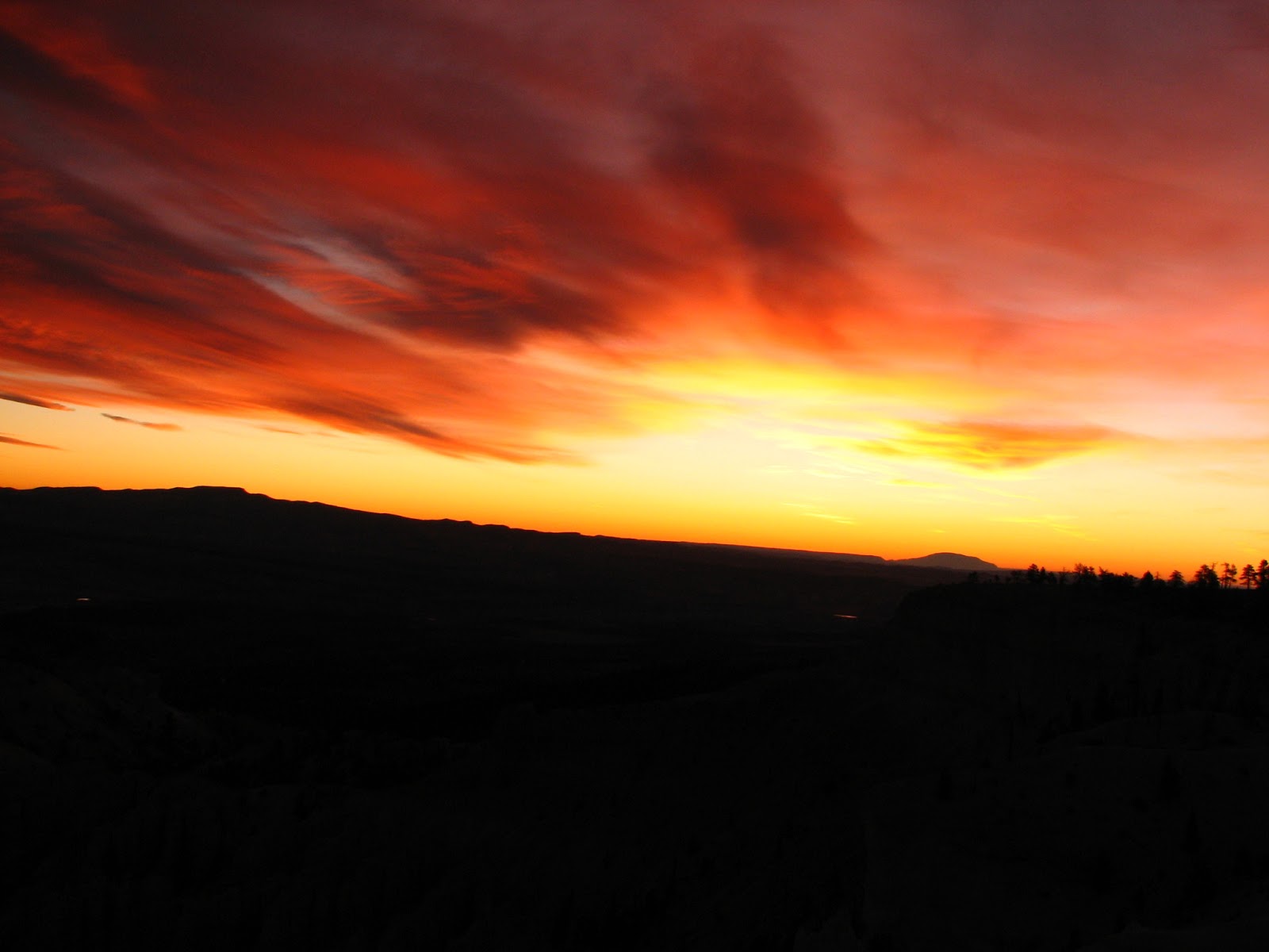
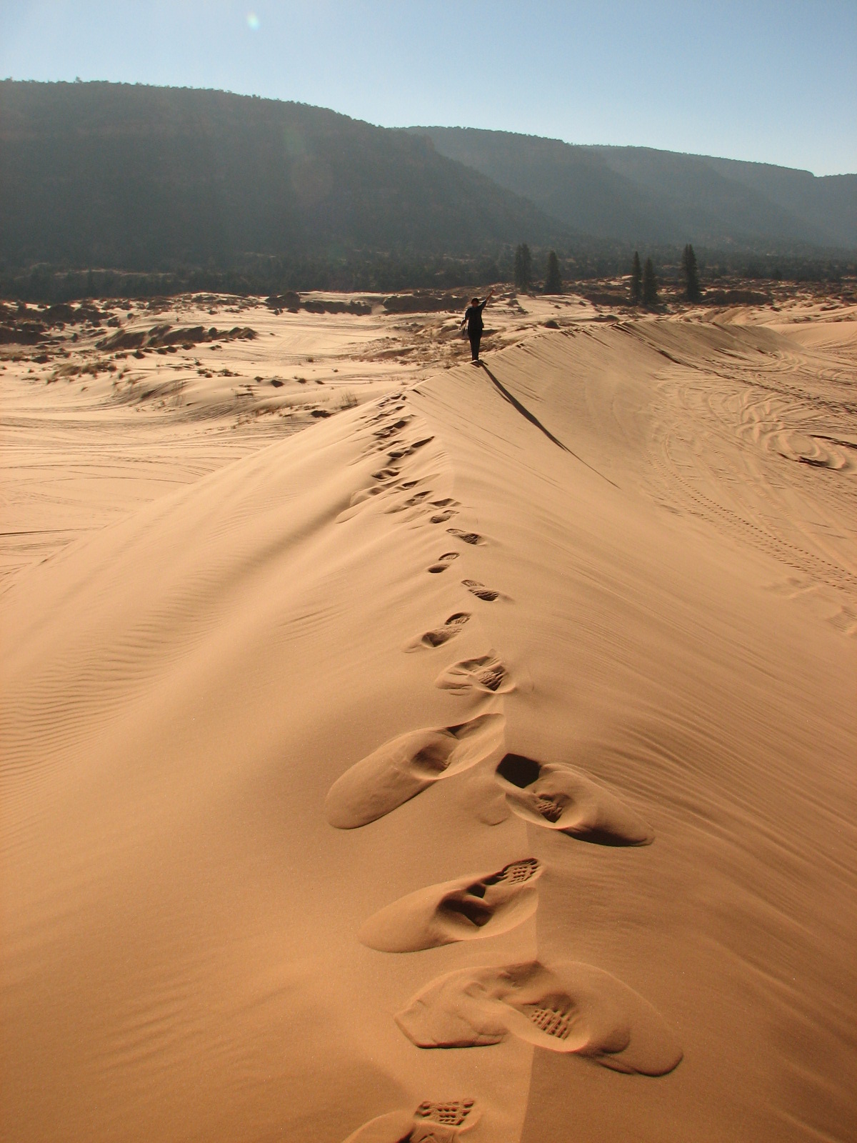
Saturday, September 01, 2007

Launch Pad to Apostle Islands - Bayfield, Wisconsin

The visitor center for the Apostle Island National Lakeshore is located in Bayfield, WI – a small fishing village that is charming, delightful and friendly. Only an hour’s ferry ride across from the Victorian town of Bayfield, WI – the 21 islands of Apostle National Lakeshore, form one of the most beautiful and unique landscapes in nature.

It is here that all is forgotten, and you live entirely in the moment absorbing the beauty that is the lake, the soft sandy beaches, the wooded forests, the big blue sky and the peace and quiet that is so rationed anywhere else in the cities.

There are many websites that have detailed information to help with planning for such a trip. But preparing for it is one thing, experiencing it, quite another!
Although reservations are necessary for camping at the islands, the camp sites are taken on a first-come first-serve basis. With private boats that are allowed to dock at various times, you are lucky if you catch a camp site that is close to the dock. Regardless, the minimal back country camping is not difficult and in fact quite a fun exercise to do…since your excitement is already on overdrive.

Each campsite has its own appeal, with exclusive vistas of the large Lake Superior and the beach flanking its one side, the wooded trails and forests, its other. All complete with a spacious tent pad area, bear-proof food lockers and excellent fire rings and grill…the campsite became a second home tucked into nature.
Three days on the island, gives you plenty to do and loads of memories to make that will last you a lifetime. There is hiking, kayaking, boating/sail boating, swimming, chilling out and much more. Its entirely up to you to make your memories, and experience nature up-close.
Stockton Island, being the 2nd largest amongst all the other islands, offers almost all of the above experiences to take in. For a detailed three day itinerary, proceed to read the next article.

Friday, August 31, 2007

Apostle Islands National Lake-shore


When someone says, “…you cannot pretend to live on an island” …I say YES YOU CAN…and not only pretense, you actually can!
A trip to Apostle Islands in Northern Wisconsin….felt like a place so remote, so removed from inhabitance and created for the ultimate R & R (rest and relaxation) experience!

Saturday, April 28, 2007

Rutherford Hill Winery

With nearly 300 large and small wineries to choose from, selecting one to tour and taste wasn't easy. What was interesting for us certainly may not be on the priority list for some one else. But if you really wanted to experience the wine-making process, the tasting as well as the most extensive cave system for cooling and ageing...then I think Rutherford Hill is your best bet.
As the name suggests, it is located on a hill, and commands spectacular views of the valley.The whole place has such an "italian" look and feel (and I have never visited Italy...but want to now). They run hour long tours 2 times a day and 4 times on the weekends.
Founded in 1976, Rutherford Hill Winery is one of the leading Merlot producers in the United States.They believed that the Valley's climate and soil, were well suited to Merlot and were among the first to pioneer what has become one of Napa's premier varietals.
The tour is a very informative one, taking you through all the different stages of wine-making such as harvesting, crushing, fermenting, barreling and ageing. What is unique and distinctive about it, is that it includes a walk through the extensive cave system where you get to taste one of their fine Merlots taken directly from the barrel.
Rutherford Hill was one of the first to recommence the construction of barrel-ageing caves in this century. Rutherford Hills caves extend nine-tenths of a mile into the volcanic ash behind the winery. These caves contain over 8,000 French and American oak barrels in which all of the winery's harvests are matured. This unique, natural environment enhances the wine-ageing process and produces wines of consistent, notable character.
And not to mention on a hot scorching 85 degree day...the caves were natural airconditioners and gave a much needed respite from the heat and exhaustion. The tour ends in a special cave-dining room which is beautifully decorated with white-linen tables, vine-trellises and exudes a magical V.I.P appeal!
With 5 top varieties of wine to taste from...a informative wine-making tour, a unique cave experience and olive-grove orchards(see TIP)....you wonder how can a vineyard have it all??? You have to visit it to believe it.

TIP: Surrounding the perimeter of the vineyard are picnic-perfect olive groves that are absolutely a delight to sit and enjoy an afternoon lunch. Just make sure, that if wine is part of your bread basket, that you buy it from Rutherford Hill. It comes highly recommended and certainly makes the visit worth it.

Friday, April 27, 2007

Wine country for Non-Connoisseurs


Much against popular belief, Wine country is Northern California...is bubbling with lots of things, other than just wine.
I mean the cliche` thing to do would be to drive...or as the case may be, be driven to visit one winery after another, and to sip and taste one wine after another. And this would make perfect sense to someone who enjoys and appreciates good wine.


For us, we belong to the category...that is the title of this article. So, I have to say, Wine and Vineyards are so much more than just to taste and get drunk (yes...people do have agendas behind such a trip)....they usually have a predesignated driver, or have a fancy limousine ride them while they indulge in the art of wine tasting (after a point, its really drinking/gulping down)!
We had never been to this part of California, and had read and heard enough about its beauty, to want to visit it anyways. And I am glad we did!


"Spectacular", "scenic" and "breathtakingly gorgeous country" would be some ways to describe what our eyes feasted on. Its a pity, this part of the story never gets told...at least not in person (people generally are too drunk to recollect). But half the fun is in getting there! Its amazing, how the rolling hills beckon you towards their every bend and turn, and how each winding road, reveals a magical and sensational view briefly giving you a glimpse into what Tuscany in June might actually look like! It was truly a treat.
So for all of you out there, who ever thought, that you don't drink...therefore what is the point in going to Napa...reading this, and watching the pictures should motivate you enough to jump-up and go! Take "shots"...I mean with the camera, and "taste" the fresh smell of grape in the air. The weather is one thing, you will never have to worry about, and it will be a trip hard to forget.

TIP: This tone of this article would have been completely different, had we driven on Highway 29 through the heart of Napa....that is NOT the way to see and appreciate the hills around here. If you want to loose the crowds, and get your complete fill of wine, tours and tasting, I would highly recommend taking the scenic and peaceful Silaverado Trail (it runs parallel to Hwy 29 all the way upto Calistoga).
Sonoma Valley is another quiet and commercial-free town to experience the vineyards and the culture.